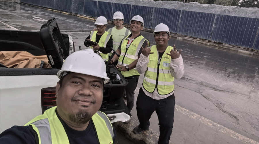
All Kinds of Surveys and Mapping
Our team ensures accurate boundary identification, topographic mapping, and detailed land data essential for development, design, and planning projects.

Tecphil Surveying and Mapping Services began its journey in 2022 as a specialized unit under Tecphil Geosolutions Co. (TGC), initially focused on providing special training and technical assistance for TGC clients. As the surveying industry evolved, with increasing demand for more innovative, and large-scale solutions, we expanded our scope to conduct specialized and advanced surveys, ensuring efficiency and precision in geospatial data collection for our clients.
READ MORE
At Tecphil Surveying and Mapping Services, we provide precise geospatial solutions for construction, land development, engineering, infrastructure, and government projects.
Our team ensures accurate boundary identification, topographic mapping, and detailed land data essential for development, design, and planning projects.
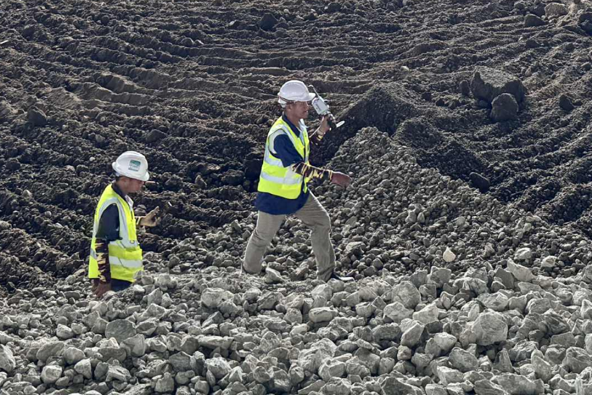
Our engineering surveys deliver critical measurements and elevation data that guide engineers and contractors through every phase of infrastructure development.
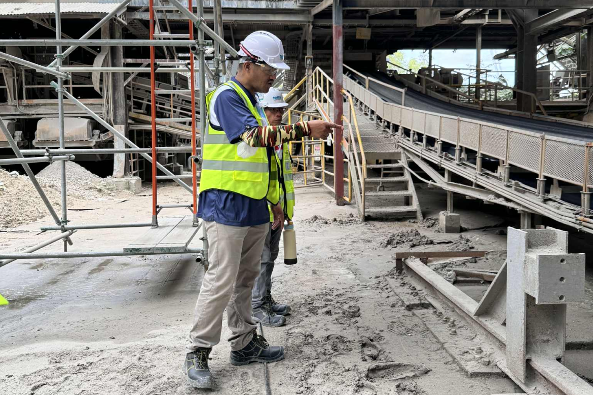
Our process ensures safety, compliance, and reliability by assessing current conditions and supporting renovation or expansion requirements.
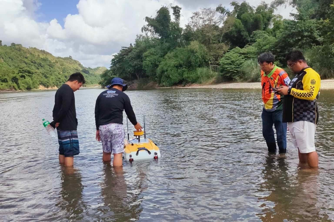
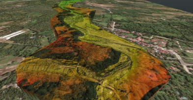
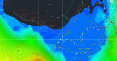
Our hydrographic and bathymetric surveys map seabeds, rivers, and lakes with precision, providing essential data for coastal engineering and marine navigation.
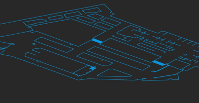
From layout to verification, our surveys ensure every structure aligns perfectly with design plans and technical specifications.
We design customized surveying solutions to meet specific client needs. We deliver innovative results that adapt to complex environments and unique project goals.
We conduct a full range of land and infrastructure surveys providing accurate, efficient, and data-driven results for every project.
We conduct a full range of land and infrastructure surveys providing accurate, efficient, and data-driven results for every project.
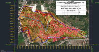
Provides detailed mapping of land elevations, features, and terrain used for design and land development.
Our team specializes in route alignment and profile surveys to support the design and construction of infrastructure projects.
Measures underwater depths and seafloor features to produce detailed maps for marine and coastal development.
Divides large parcels of land into smaller lots in accordance with development plans and government land regulations.
Measures and maps underwater features, depths, and tides to support ports, bridges, and coastal infrastructure planning.
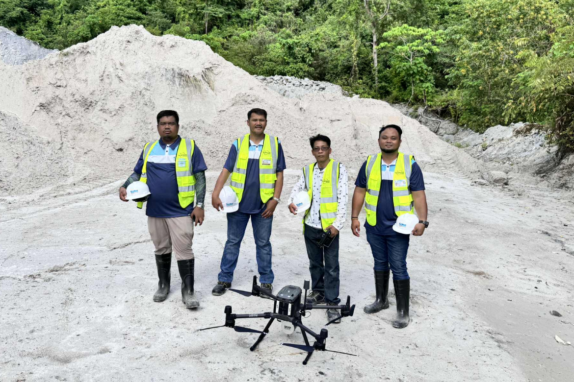
Captures aerial images and surface data using drones to produce high-resolution maps for analysis and project planning.
Transfers design plans to the field with precision, ensuring correct positioning and elevation of structures on-site.
Records the actual location and elevation of completed works to verify compliance with approved design specifications.
Provides accurate mapping and elevation data for efficient land-use planning, farm layout, and development projects.
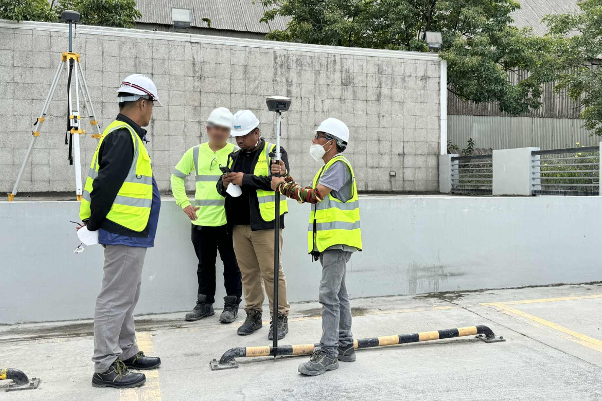
Our use of GPS and GNSS RTK (Real-Time Kinematic) systems enables centimeter-level accuracy in land surveying, construction layout, and infrastructure mapping. These systems significantly reduce field time and post-processing, ensuring reliable positioning even in remote or challenging environments.
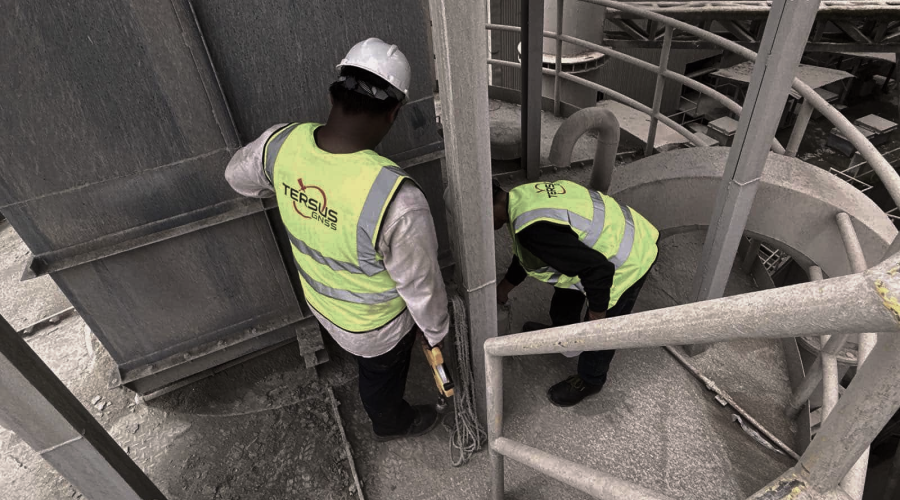
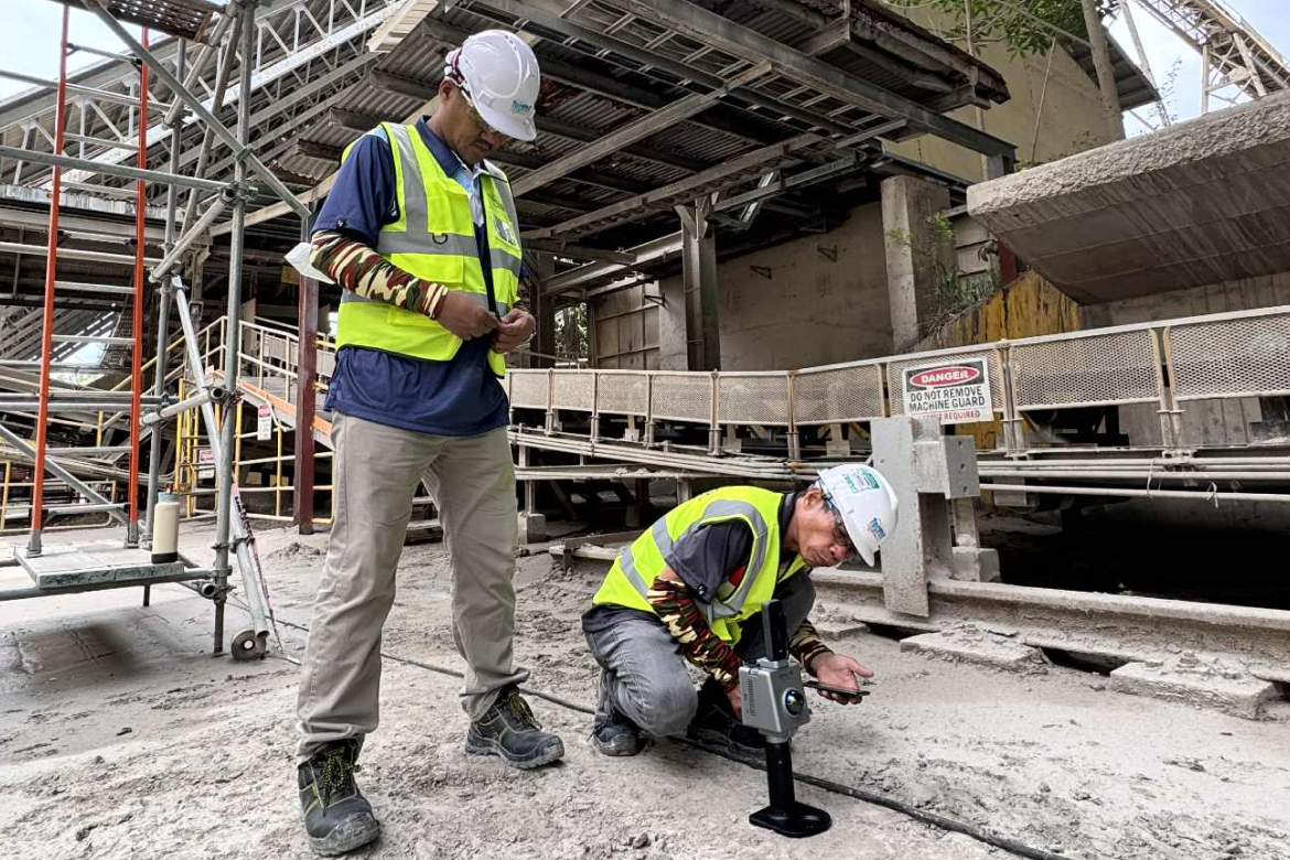
We deploy a Multi-Platform LiDAR System—integrated across UAVs, vehicle mountings, and handheld devices—to capture high-density 3D point clouds for topographic mapping, vegetation analysis, and structural inspections. This versatility allows us to survey large or inaccessible areas quickly and safely.
For indoor and GPS-denied environments, our SLAM (Simultaneous Localization and Mapping) scanners provide real-time 3D mapping capabilities, ideal for building interiors, tunnels, and heritage sites. These portable systems offer fast deployment and accurate spatial data without the need for satellite signals.
Complementing our data acquisition tools is our suite of Advanced GIS and Mapping Software, which enables powerful spatial analysis, visualization, and decision-making. These platforms integrate data from multiple sources, streamline workflows, and support applications in land use planning, environmental assessments, and asset management.
In hydrographic surveying, we utilize Unmanned Surface Vehicles (USVs) equipped with Single Beam Echo Sounders to conduct bathymetric surveys of rivers, lakes, and coastal zones. These autonomous systems offer safe and cost-effective depth measurements, especially in hazardous or shallow waters, with minimal human intervention.
Ground Penetrating Radar (GPR) technology allows us to investigate subsurface features such as utilities, voids, and geological layers. GPR is invaluable for non-invasive underground mapping, offering high-resolution data for construction, archaeology, and environmental studies.
Explore our portfolio of successful projects built on precision, innovation, and trust. From energy and infrastructure to land development, every project showcases our dedication to quality results and long-term client partnerships.
Whether it’s land development, infrastructure, or engineering projects, our team is ready to provide precise and reliable geodetic surveying services.
Contact Us Now